A new way to play around, literally, with social media: Empire Avenue
Niederbronn-les-Bains
Although it has taken me months to write about our trip around the Hexagon up to this point, we’d actually been traveling for a week and a half: one night in Seyne-les-Alpes, three in Risoul, two in Annecy, one each in Amphion-les-Bains and Besançon, and three in Colmar. That summary, however, doesn’t include the 20 or so towns we visited near and between those places, so you can imagine that we were pretty tired. Continue reading
Château du Haut-Kœnigsbourg
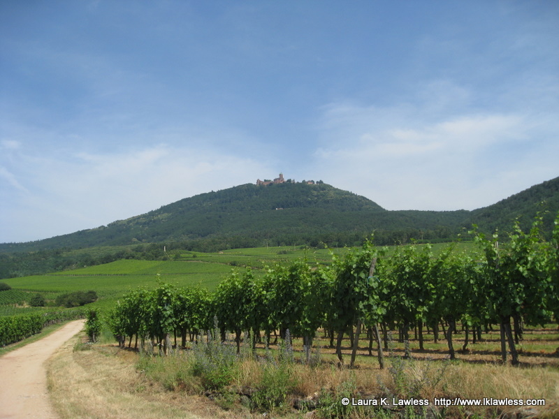 |
| From a distance © LKL |
Originally named Staufenberg, this fortified castle was built by the Hohenstaufen, a German noble family, in the 12th century. The name changed to Königsburg (king’s castle) and eventually, in reference to its altitude of around 3,000 feet, Hohkönigsburg (king’s high castle), which was adapted in French to Haut-Kœnigsbourg.
Coming soon: the rest of the Hexagon
Last summer, I started writing a series of posts with the highlights of my marathon trip all the way around France. A couple of months in, I decided that I wanted to describe the trip in more detail for my French site, and essentially abandoned this blog, leaving you all stranded at the fourth corner.
Now I’m changing my approach once again.
As much as I love writing about France, bilingual articles are simply too labor intensive. Between researching each place, writing about it in French, and then translating into English, those features required an inordinate amount of time. One of the reasons we moved to Menton was in the hopes that living in a beautiful, tranquil town would inspire me to work on a book that I’ve had in mind for years. Now that we’re settled, the inspiration is there, but the time isn’t, so I’ve decided to compromise. I’ll keep writing in-depth articles about France, but only in English. I’m going to continue from where I left off on the other site, and I’ll update the same map – you can see what I’ve done so far here: Six corners of the Hexagon.
(P.S. I’m not ready to talk about the book yet, but you’ll be the first to know when I am.)
6 corners of the Hexagon: Fourth corner!
 The fourth corner of the Hexagon, at least according to the way we mapped out our trip, was the southwesternmost point of France. This is at the Spanish border, in the heart of Basque country, and the French side is Hendaye, one of the largest towns in the Pyrénées-Atlantiques department. The beach is lovely, and from the languages we heard seems to be equally popular with swimmers and sunbathers from both sides of the border. The end of the jetty is the actual corner; to the left (south), across the water, you can see a bit of Spain.
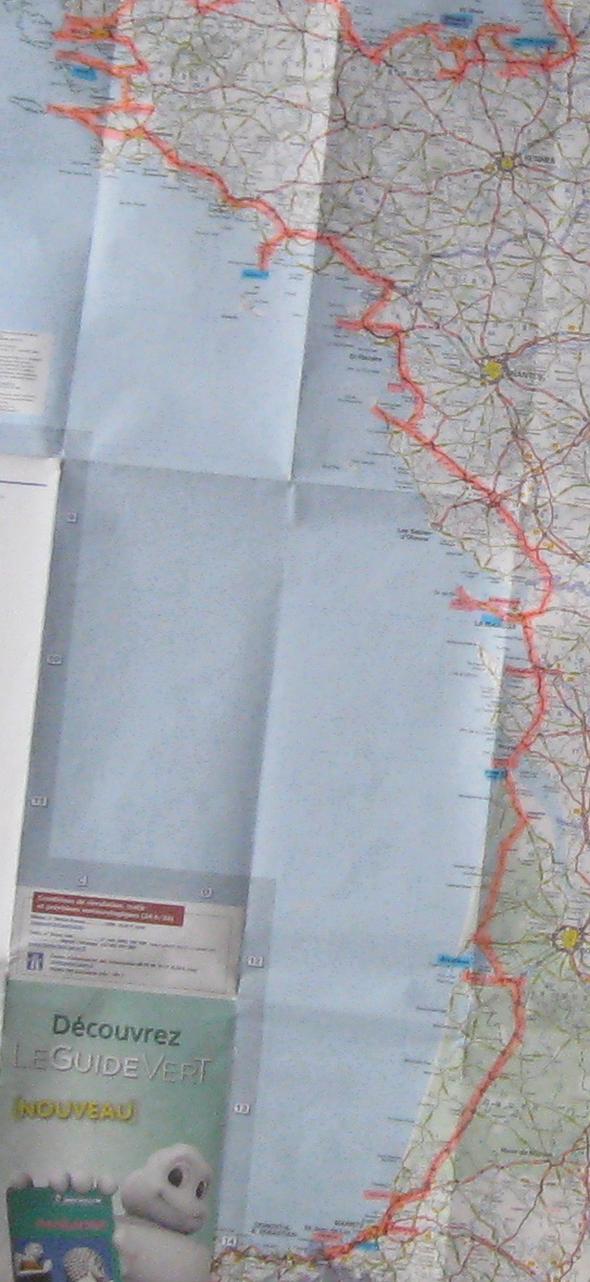 Here’s our map between the third and fourth corners. As always, pink indicates our route as well as towns we actually walked around and/or ate in, while blue highlights where we stayed. You can click the map to see a much bigger version (MB).
– – – – –
6 corners of the Hexagon: Basque country
After traveling almost constantly (one three-night stay, a few twos, but mostly singles) for about three weeks, ever since leaving Chinon, we were grateful to arrive in Guéthary, just north of Saint-Jean-de-Luz. We stayed in a little vacation apartment for a week and were able to catch up on laundry and even do some cooking.
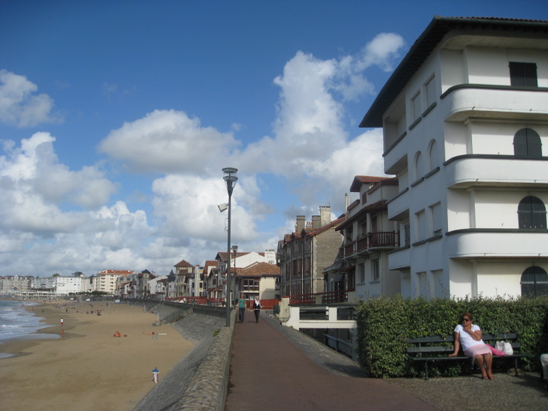 |
| St.-Jean-de-Luz © LKL |
Guéthary is tiny and cute, but Saint-Jean-de-Luz and neighboring Ciboure are truly lovely. We’d thought that it would be quick and easy to get there from Guéthary, but traffic was horrendous, even in September: there’s a toll road, but most people choose the free and therefore far more crowded Route Nationale. So we only spent one afternoon in St-Jean-de-Luz; it’s definitely on our list of places to revisit.
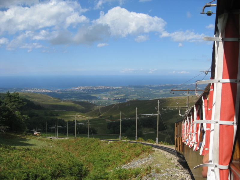 |
| Petit train de La Rhune © LKL |
One of the best parts of the week was our trip on le petit train de La Rhune, a cog railway that ascends 905 meters to the top of the La Rhune massif and offers a spectacular view over Basque country.
– – – – –